There was this shadow at work. No, not the "Me and my shadow" type, a red and black Honda Shadow that I saw in the parking lot every day I came in to work, and gone by the time I left.
 |
| Cape Enrage New Brunswick |
I was late for the Red Isle Riders Bike Night, but managed to stir my lazy butt up and out in time to meet up with the gang, and shortly a woman walked up to me, introduced herself as Caroline, and told me she recognized my bike from work, etc etc. We finally got a chance to put faces to names, and over the next day or two we decided that a ride off island was in order, and I invited her to join me for fish & chips at The Boathouse in Alma New Brunswick on the shore of Fundy Bay. "Absolutely!"
Friday night rolled around and I found myself laying out my gear for the ride the following morning, excited because I had convinced someone to partake of my madness... I needed to make a good initial impression so I could lull them into complacency and trust in my navigation skills and riding ability. Muahahahaha!
 |
| The Grand Plan |
Don't be deceived, I talk way to much at each stop, and managed to eat up all our extra time...
 |
| Of course you meet for a coffee |
I believe I mentioned kickstands up at 0830 but I wouldn't take the hint when Caroline started looking at her watch, and continued telling riding stories ad nauseum so we were fifteen minutes late getting underway. So much for good first impressions.
It was cool! I'd dressed for fall weather, but wasn't expecting it to be so brisk, so the first order of business was to pull in to a parking lot and get out a couple of extra layers. Brrrr!
Leg 1 - Charlottetown to Lower Sackville NB - 109 km
 |
| Leg 1 - Charlottetown to Lower Sackville NB - 109 km |
Okay, time to get off the island and get onto my favourite little side cut, NB Route 955 through Murray Corner and out onto 15 towards Moncton... But then we shot across NB 940 bound for Lower Sackville NB, where we refuelled and grabbed a cuppa (And chatted again) while an enthusiastic group of University Students hit us up for a donation for Shine O Rama or something. Lol. I'm an easy touch, but have a poor memory.
Leg 2 - Sackville NB to Alma NB - 158 km
 |
| Leg 2 - Sackville NB to Alma NB - 158 km |
Time to get moving if we want lunch as opposed to supper, and we headed through the town and onto NB Route 106, where the fun began. I completely missed 925 in the heat of the moment, and then I managed to impress Caroline with my navigation skills by arriving in Memramcook NB and promptly ignoring Garmin's sage advice, and leading us miles out of the way down the opposite bank of the Memramcook River before I caught the mistake, and sheepishly admitted to Caroline that we had to go back thataway. Oops! (I may have mentioned that Garmin steered me wrong at the time)
We navigated Moncton well enough, but by the time we hit Riverside, I had to go recycle my coffee and tea from the morning, and we got a good wee visit with a very well mannered Rottweiler named Sassy, who kindly permitted us to pet her for a few minutes.
Once out on the road again with Caroline leading, we promptly got stuck behind some motorists who were confused by signs that said things like "80 km/h" and insisted on driving at their own pace, that of a retirement home resident dashing to make the first sitting for lunch with their walker... Slow and impossible to get round, but Caroline managed and we enjoyed the sight of the tributaries emptying into the Petitcodiac River as it winds its way out into the Bay of Fundy, then seeing the Bay itself appear in the distance, just down from the rise we were travelling on. Sorry, my main camera is out of action as I lost the battery charger for it somewhere in New Hampshire's White Mountains, so no pictures this time. *sigh*
I was trying to shepherd her to Shepody Marsh at Harvey Bank NB, and managed to get us off the highway onto a wee asphalt lane that turned a corner and became a gravel access path for farmers out onto the pastures that border the marsh. I asked if Caroline wanted some help mounting knobby tires on her shadow, but she gave me a look. "That" look, and I knew that I had better get us back out onto 114 and get us moving on the macadam. Hey! A covered bridge! I freely admit to assessing her bike, her demonstrated riding skill, and the depth and quality of the gravel, before deciding that she had the "Right Stuff" and led her up to the wooden structure. "Hold on here for a minute of two, I want to take a video of you riding across the bridge!" Another bald faced lie as I prefer sequenced shots so I could pick the best of the best. :)
 |
| Sawmill Creek covered bridge, Hopewell Hill |
Ain't technology grand? And now for your viewing pleasure, MOVING PICTURES!
 |
| You can't take a car across this anymore, but a horse might just fit. |
I got us back out onto the pavement, and remembered the road that we needed to get out to Harvey Bank was the 914! Once on it Caroline took the lead again, until the turn for Harvey Bank, for as much as I love to talk, I'd forgotten to tell her what we (I) was up to that we needed to make a wee detour out to the marsh via the tourist trap the town has got. A fake lighthouse near what I believe used to be the boat pond of the shipyard that once graced this small farming community.
Lifted from the New Brunswick Provincial Archives:
Located on the Shepody River, 3.18 km SE of Riverside-Albert and 2.26 km NE of Harvey: Harvey Parish, Albert County: PO 1882-1950: in 1866 Harvey Bank was a farming settlement with approximately 23 resident families: in 1871 the community had a population of 150: in 1898 Harvey Bank had 1 post office, 1 store, 1 sawmill, a shipyard and a population of 190.
 |
| Shepody Marsh near Harvey Bank NB |
 |
| This is only navigable at high tide, so the boat pond is protected by a lock system. |
 |
| Look like you own the bike and not the bank... |
A couple of older ladies drove up and we chatted with them about the weather, the area and sights. One was up from 'Murica so we avoided politics and chatted merrily about wither we were bound, Cape Enrage, the lunch that awaited up in Alma, and other minutia. It was all smiles and laughs until I told them that we wouldn't be taking the loop through the conservation area or dropping into the art studio, lol. One of them said I am going to have to visit again with a bike that will handle a rough road. :'(
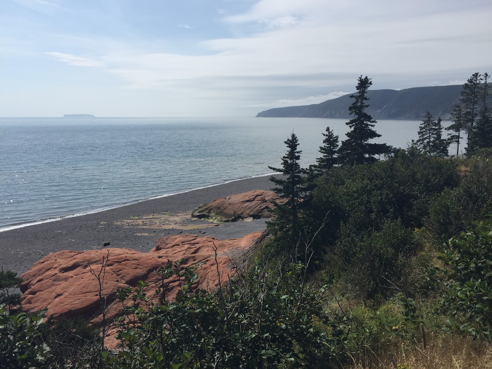
We got back out onto 914 and I warned Caroline to be on the lookout for a lighthouse sign on the left for Cape Enrage Lighthouse, and off we went down that bumpy road for about fifteen kilometers of spine cracking "How's your Mama?" krazy quilt New Brunswick rural roads. What do I mean by Krazy Quilt? Road patches on patches, on top of patches. Yep, marked as 80 kph, but only if you are part of the Hare Scramble... Caroline set a good pace, and I was happy to butterfly watch as we hit the high ground and could see out over Fundy's majestic shoreline.
Remember that lighthouses are placed to warn sailors of navigational hazards? In this case a towering cliff of rock located on the remote end of the cape. The access road out to that lighthouse is not straight and level, and while I gave Caroline a brief warning about the curves, I didn't want to scare myself, so for once I kept mum and simply told her that taking it easy was the plan, and watch out for the hairpin corner.
 |
| The view from the top |
 |
| Back just a bit further, Ron. A bit more... |
I need to fire my current barber, but at least I'll have a great scrapbook for the personal care workers to peruse later in life while I sit in my chair and drool on myself.
 |
| Where is Waldo? Hahaha, yes, timing is everything. |
 |
| Wow, is she ever short! |
Once Caroline kicked my butt off the top of the beach and down a bit lower, the photo improves. :D
 |
| Selfie Photo Bomb! I forgot the rabbit ears. Next time! |
Man, this place is beautiful, but you have to use caution on the roads and ensure your skills are up to hairpin corners, and sharing those curves and hills with other motorists. Caroline admitted to a wee bit of white knuckling during the ride, but I think she deserves a pat on the back for staying the course. Gold star time! I am not going to ask you to do a search of the this blog for "Alma" and read my story of six years ago and this same road...
 |
| That road leads to a steep ascent and a could of hairpin corners |
 |
| That road can be fun too. |
 |
| It's hard to believe that the ocean will flood past the breakwater right up this plain. |
Oh my! It's after 1400 and I promised this girl "lunch", not supper! It's taken us six hours to get this far today. Perhaps I'd better do less talking and more riding...
 |
| Itotallyforgetthenameofthisbeautiful River, Cape Enrage NB |
915 led us back down the ridge and into Alma, and I scooted ahead of Caroline again to show her where to park for the Boathouse Restaurant. No pictures of the fantastic fish & chips, but rest assured we got our monies worth. Caroline alleges that for an East Coaster, the best fish & chips she ever had was served to her in Las Vegas Nevada. Game on, prove it! Let's go rent a bike and check this place out, as well as the Grand Canyon and that damn Dam thingy that was named after a vacuum cleaner!
Leg 3 - Alma NB to Charlottetown PE - 265 km
 |
| Leg 3 - Alma NB to Charlottetown PE - 265 km |
Both Caroline and I wanted to be off the mainland before dark, as neither of us relished a night ride out on 16 where the risk of collision with the wildlife is pretty high, and as it was now three o'clock and we had three hours of riding ahead of us, it was time to dispense with the The Grand Plan, and get moving via the Trans Canada if we wanted to be back on our island retreat before sunset.
So off through Fundy park we went with Caroline in the lead, the sound of her scraping pegs warning hikers and tourists that we were not stopping for anything less than four legs, a rack, and a metre tall. Seriously, the very first turn near the top of the hill by the parking lot? She one ups me and gets some decent lean angle! My grin was hidden by my helmet so I flashed her a thumbs up, and off we went up the hill and out of the park, homeward bound.
Thankfully she stopped just before the highway on the 114, and we put back on the layer of clothing that we'd removed at the restaurant. Not only did I don my heated vest again, I actually plugged it in as I was fairly certain that I'd be suffering from the early autumn chill well before reaching the Northhumberland Strait and the Borden-Carleton Esso where Caroline promised to let me stop and buy me a tea if I would only do my best to keep up to her on the turnpike.
She's quick. I manged to keep up and enjoy the ride, but it was getting windy, and brisk, very brisk. (Don't tell Caroline, but I flipped the switch on the vest at Salisbury, then turned it off when I pulled into the underground at my place, she'll think I'm a wuss. )
We got hung up behind some tourist RV out on 15 long before coming in Port Elgin, and with a conga line of cars behind them, and all quite content to do 10kph LESS than the posted limit, so when Caroline pulled off onto the south end of the 955, I was sooooo happy! She pulled over and asked if I was going to be okay for gas, and I gave her a grin and a thumbs up, and we made decent time retracing our route back up the bridge.
 |
| The estuary at Murray Corner NB |
It was windy! As I told Caroline, I can't remember another crossing where my bike got tossed around so much. I managed to make it across the bridge, with visions of free hot tea as my reward.
We pulled into the Esso station on this side of the bridge, gassed up for the final time of the day, and sat down with our drinks to chat with a few other bikers there, before heading off on one more wee adventure, down 10 through Cape Traverse and out into Tryon where we headed into Crapaud and North up Route 13's many twists and turns before heading into Charlottetown via the Kinkora road.
 |
| Sunset over the potatoes fields of Cape Traverse PE |
 |
| Our last sight of the sun, viewed from Tryon PE |
And thus ends the tale of how it took two modern bikes and skilled riders six hours to get there, and three hours to get back.
What an awesome day!
Expect more from me if the weather is good next weekend as I promised a bit of a Dawn to Dusk ride to a few of the Red Isle Riders. St. Martins AND Advocate Harbour rolled into one. :)