I looked at the google map of Prince Edward Island, and it slowly sunk in that I'd ridden to every cape and along every coastline on the island. What now? I'd find myself in familiar territory if I rode out in any direction. Then I thought of Hopewell Rocks provincial park on Shepody Bay in New Brunswick and google informed me that it was a mere two and a half hours away! A quick check of the tide tables and I was delighted to find that if I left the island in the late morning, I'd arrive at the park in time for low tide at 12:19, and be able to walk the beach for the following shots. Perfect!
The flower pot rocks of Hopewell Rocks
 |
| Crapaud PE to The Rocks Provincial Park NB http://goo.gl/maps/oLBuW |
Those blue lines on the map above do nothing to indicate how cool it was in the morning, and as my brother-in-law Kirk and our friend Mike was meeting me at 0930 in the morning, I showered up and looked at what gear I had laid out the night before, which included some insulated coveralls that I eschewed in favour of wearing three pairs of pants. That proved to be a mistake as our first hour saw us riding in temperatures of three to four degrees, and while my heated grips and jacket made my hands and core nice and toasty, I could definitely feel the cool wind on my knees, thighs and calves. When we crossed a very windy Confederation bridge, I found that I'd left behind something very important to the ride, as I tried to snap a photo of the Cape Jourimain lighthouse and the camera failed to turn on! I tried again with extra care, and realized that I knew exactly where the battery was... In the charger beside my bed where I'd left it last night. Bugger! That meant that the only camera I had with me was my cellphone, and although it takes some great pictures, I'd have to stop for every shot, open up the tank bag and pull off a glove in order to operate it, and the sensor isn't as good as that of my Panasonic Lumix DMC-TS3.
We rode off the bridge, and took the first exit off of the Trans Canada onto NB 955 that is a truly beautiful ride along the coast of Cape Jourimain, through a small slice of Acadian New Brunswick, that is a delightful twisty stretch of road that is a bit of a shortcut towards Port Elgin from the foot of the Confederation Bridge. The fall colours and light in the area made me curse the lack of my camera, but I consoled myself with the thought that I'd already photographed much of the coast earlier this summer.
 |
| NB 955 along the coast |
I can be such an idiot, but I warned Kirk and Mike when we stopped at the Dieppe Tim Horton's that they may lose me from time to time taking pictures, but I'd do my best to catch up, which wouldn't be terribly hard as Mike found that stator on his KLR didn't like the load placed on it by his heated vest if he rode over 104kph.
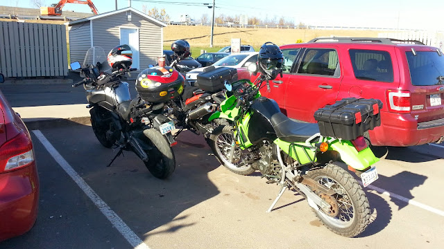 |
| Tim Horton's stop |
Entering and leaving the city of Moncton simply reminded me of how much I detest traffic and the whimsical actions of cagers. Once we were across the bridge and heading south on NB 114, I relaxed and enjoyed the sweeping progress of the road that parallels the Chocolate river.
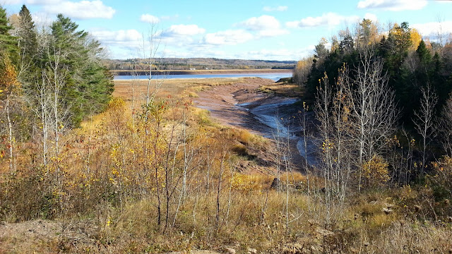 |
| In the distance, the Petitcodiac river fed by a tributary |
 |
| A tributary of the Petitcodiac river |
http://en.wikipedia.org/wiki/Petitcodiac_River
As you leave Moncton and ride south on NB 114, you'll see many sites like this, but it may be impossible to stop for as they tend to be curved stretches of road with narrow shoulders, and I was fortunate enough to be able to park for them in the light traffic that Saturday afternoon.
NB 114 is a wonderful bit of road, although fairly well travelled with towns up and down its length, I found it a bit rough on the Versys suspension in places, but a fun scenic jaunt, and I wasn't feeling like pushing it that day which is probably a good thing considering how cold the asphalt was. It was certainly more entertaining than our ride out from PEI with the exception of NB 955.
 |
| How much time do I have?!!! |
We arrived at the park, and as it was late in the season, the gates were closed, the parking area closed up tight, but not tight enough to keep out those who braved the cool autumn temperatures and closed gates to to see the sights on this lovely October day. It's about a kilometre from the gates to the Flower pot rocks, and there were more people there than I thought there might be.
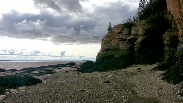 |
| The overcast sky played hob with my pictures. |
 |
| Someone had placed this ladder for determined site seers such as myself. Thanks! |
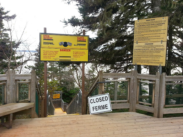 |
| But not quite. Enter at your own risk |
 |
| So that's where they are! |
 |
| The intrepid explorers await my return... |
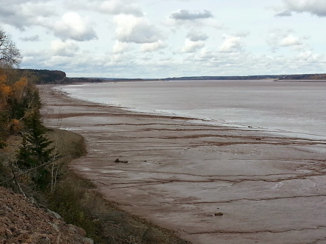 |
| I think the tide is starting to come back in now |
 |
| NB 114 has this and much more in store for you |
The rest of the ride, we could feel the temperature drop, and our butts begin to burn, just to the point where you start moving around trying to ease the pressure. By the time I got back into Crapaud, I was cold, tired and elated at a wonderful fall ride, and perhaps the last full day ride I would be able to do at these temperatures, for I've seen -1 in the forecast for this coming week, and that doesn't bode well for a bike with a rear tire that is almost on the wear bars.
If that's it for the season, then I'm happy that I ended it this way. No regrets with the exception of leaving my camera battery behind. DOH!
